































U.S. Army Awards Tern $11.26M Contract for GPS-Independent Navigation
Tern won an $11.26 million U.S. Army contract to deploy GPS-independent vehicle navigation technology that works when satellite signals are unavailable.
Austin-based startup Tern has secured an $11.26 million U.S. Army contract to deploy navigation technology that keeps military vehicles positioned when GPS signals are unavailable or disrupted.
The Army will use Tern’s system in vehicles, although the company has not disclosed the scale of the deployment. Tern describes its technology as “Google Maps for the battlefield,” with a system that determines a vehicle’s position without depending on satellite navigation.
Tern targets navigation without GPS
GPS interference has become an increasingly important concern in military and civilian environments. GPS jamming and spoofing can disrupt satellite-based positioning, creating demand for navigation systems that can keep operating when those signals are unreliable.
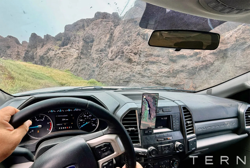
Tern’s approach uses information a vehicle already produces while it is moving. A device connects to the vehicle’s diagnostics system and is wired to a tablet, providing soldiers with positioning, navigation, and routing information.
CEO and co-founder Shaun Moore said the system passively receives vehicle data without disrupting its normal flow. Tern then uses proprietary methods and edge processing to convert that information into latitude and longitude coordinates.
“There is quite a bit of work that was done to get it to the point where we can just receive that information and then output latitude / longitude,” Moore said.
Because the positioning is calculated independently, Tern says the technology can operate on and off roads as well as in environments such as tunnels and deserts where conventional GPS may be unreliable or unavailable.
A closed system designed to resist disruption
Co-founder Brett Harrison recently tested the system during a roughly 1,300-mile drive from Austin to Laguna Beach, California. According to Harrison, Tern maintained the vehicle’s position throughout the trip while traditional GPS lost its location dozens of times.
The company also emphasises that its navigation technology operates as a closed system. That makes it more than a simple GPS backup because an adversary cannot disrupt it in the same way it could interfere with external satellite signals.
The Army’s interest comes as the U.S. military has explored technologies intended to provide resilient navigation when GPS is compromised. Military GPS interference has also attracted scrutiny outside combat zones, including questions about whether military testing may have contributed to a fatal civilian aircraft crash in New Mexico.
Years of testing lead to Army deployment
Harrison, a military veteran who served in Afghanistan with a special operations task force, said his experience helped shape the company’s focus on navigation technology that could work under real operational conditions.
He said Tern built the system with deployment and scale in mind rather than treating the technology as an experimental research project. The Army contract now moves that work into a larger operational setting after years of development and testing.
For the Army, the technology offers another way to maintain vehicle positioning and routing when access to GPS cannot be assumed, an increasingly important requirement as electronic warfare makes satellite navigation more vulnerable to disruption.
What's Your Reaction?
 Like
0
Like
0
 Dislike
0
Dislike
0
 Love
0
Love
0
 Funny
0
Funny
0
 Angry
0
Angry
0
 Sad
0
Sad
0
 Wow
0
Wow
0