Risk-aware robot navigation is the process of moving a robot through changing surroundings while accounting for what its sensors and maps cannot establish with confidence. A machine surveying an unfinished building may encounter a blocked passage, uneven flooring or workers moving equipment. It must decide whether to proceed, change its route, gather more information or stop.
The challenge is different from following a fixed warehouse line. Outdoor and industrial sites can change during a single shift, and satellite positioning may be weak or unavailable. An autonomous robot needs a current estimate of where it is, what might be in its path and how uncertainty affects its next action. Successful movement is not proof that every risk has been controlled.
A Site Can Change Between Two Inspections
Consider a hypothetical four-legged inspection robot assigned to photograph electrical equipment on a construction site. Yesterday, its route passed through an open corridor. Today, a delivery has left pallets near the entrance, a cable crosses the floor, and a temporary barrier restricts access.
A robot that follows yesterday’s waypoints may reach an obstruction or enter an area that is no longer authorized. A more adaptive system observes the present scene and determines whether another route is available within the task’s approved boundaries.
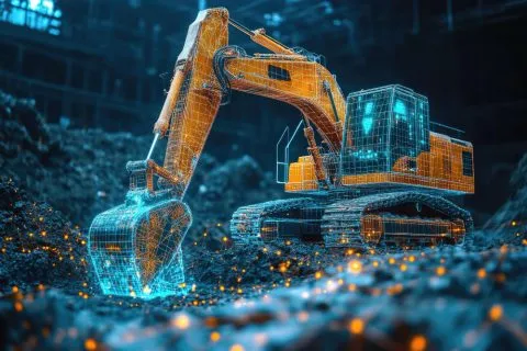
Adaptation needs limits. The machine cannot assume that an unfamiliar doorway is safe merely because it looks traversable. Construction rules, worker activity and the purpose of the inspection may require a human to approve a route change or suspend the mission. Unlike autonomous excavators that reshape the ground, inspection robots mainly observe it. Both need current site information, but their operational risks differ.
The National Institute for Occupational Safety and Health’s October 2026 guidance notes that changing construction sites and human-robot interaction create hazards that fixed barriers alone may not resolve. It calls for ongoing risk assessment and coordination with workers.
Localization Works Even When GPS Does Not
Navigation starts with localization, the robot’s estimate of its position and orientation. Satellite positioning can help outdoors, but signals may be unreliable in tunnels, near large structures or inside industrial facilities. Robots can also use onboard motion sensors, cameras, laser scanners and wheel or joint measurements to estimate movement.
Each method introduces errors. An inertial sensor can accumulate drift; wheel odometry may be wrong when tires slip; a camera may struggle in darkness; and a laser scan may match several similar corridors. Combining measurements can improve the estimate, but it does not eliminate uncertainty.
Simultaneous localization and mapping, or SLAM, allows a robot to build a representation of an area while estimating its own motion within it. The map and position estimate influence each other. A mistaken association between similar-looking locations can distort both.
The National Institute of Standards and Technology’s mobile robotics program identifies slippage, uneven floors, vibration, moving obstacles and forced relocation as important localization test conditions. These failures explain why a successful indoor demonstration does not establish dependable navigation across unfamiliar sites.
Unmapped Does Not Mean the Robot Has No Map
A robot may enter an environment without a previously supplied site map and still build a local representation as it travels. This distinction matters. Navigating without a prior map does not mean ignoring surrounding geometry or operating without position estimates.
Depending on the hardware and task, software can maintain a local occupancy map, a three-dimensional point cloud, recognized landmarks or a representation of traversable surfaces. Some systems combine several views. The useful level of detail depends on whether the machine is avoiding obstacles, inspecting equipment or measuring a site.
Maps also become stale. A newly parked vehicle may block a clear route, while a removed barrier may open a path. The robot must distinguish lasting structures from temporary observations rather than treat every mapped object as permanent.
DARPA’s Subterranean Challenge explored autonomous mapping and movement through tunnels, caves and underground spaces with degraded visibility and communications. It demonstrated the importance of tackling perception, mobility and networking together; it did not establish that a single technique works everywhere.
Uncertainty Should Change the Robot’s Behavior
A navigation model may estimate that a route is clear, but the quality of that estimate depends on the available observations. Dust can hide an object, a reflective surface can confuse depth measurement, and a poorly known position can make even a mapped obstacle difficult to locate precisely.
Risk-aware planning treats those limits as information that affects the next action. A robot might slow near an uncertain obstacle, increase its clearance, take another observation or choose a longer route with better visibility. When the available evidence is insufficient, stopping can be the appropriate outcome.
Uncertainty is not one universal confidence number. Position error, object-detection uncertainty,y and predictions about moving people concern different aspects of the scene. A model’s apparent certainty should not substitute for measured sensor quality or equipment safety limits.
NIST’s AI Risk Management Framework Map guidance emphasizes documenting knowledge limits, intended operating conditions and risk tolerances. That framework is voluntary AI governance guidance, not a mobile-robot safety certification.
Route Planning Balances Progress Against Exposure
A conventional route planner may seek the shortest path between two points. An industrial robot has more to consider: unstable surfaces, restricted areas, moving machinery, narrow clearances and locations where its sensors cannot see reliably.
A route planner can assign costs or constraints to candidate paths, reflecting travel time, clearance, estimated terrain difficulty and exposure to uncertainty. The resulting route may be longer but better suited to the robot’s capabilities and the site’s requirements.
A four-legged robot and a wheeled robot may reach different conclusions about the same route. A step or loose slope that one can traverse may exceed the other’s limits. Higher-level mission planning therefore needs actual platform capabilities, not the assumption that one route suits every robot.
Cost-based planning must not replace hard safety restrictions. A forbidden area should not become acceptable because another path is inconvenient. Approved boundaries, protective stops, and maximum operating conditions need enforcement outside a model’s drive to complete the mission.
Degraded Sensors Create a Decision, Not Just a Delay
Robot sensors can be affected by rain, dust, fog, glare, vibration and physical contamination. A camera may lose contrast while a depth sensor returns inconsistent readings. A single unexpected sample is not enough to decide that the path is blocked, but repeatedly unreliable measurements cannot be ignored.
A robust system checks whether its inputs remain usable and whether the different sensors agree sufficiently for the intended movement. If the uncertainty rises, it can reduce speed, reposition for another view or request assistance. The response should depend on the hazard, not on a generic instruction to keep moving.
DARPA’s underground robotics research explicitly identified obscurants, poor visibility, difficult terrain and communications limitations as major problems. A machine tested only in bright, uncluttered corridors has not faced those conditions.
Tests should distinguish a safe stop from a navigation failure that creates additional danger. Stopping beneath moving equipment or blocking an emergency access route can have consequences of its own, so mission design must account for where and how the machine can enter a safe state.
Onboard Decisions Matter When Connectivity Fails
Industrial robots often send inspection images and status information to remote teams. But tunnels, large facilities and remote worksites may not provide continuous network access. A control design must specify which functions remain available locally and which require a connection.
Onboard or edge processing can support immediate sensing and motion decisions without waiting for a cloud response. It does not guarantee safety. The robot still needs enough computing capacity, power and validated behavior to manage its approved operating conditions.
If a mission requires live authorization, an inspection upload or remote supervision, a lost connection may force the robot to pause or return to a designated location. Establish those policies before deployment. The machine should not improvise a new mission if it loses contact with the operator.
TechAmerica.ai’s workplace robot deployment guide covers the wider integration challenge. Local autonomy is only one component of a system that also needs maintenance, staff procedures, incident response and clear operational ownership.
Moving People and Equipment Change the Prediction
A person walking along a route differs from a fixed wall. The robot may estimate direction and speed, but future movement is uncertain. Workers can stop suddenly, turn toward machinery or carry an object that changes their occupied space.
Navigation software may predict short-term motion and choose a path that keeps distance from people. Those predictions do not guarantee human behavior. The robot’s speed, stopping distance and sensing limits determine whether a proposed reaction is physically achievable.
NIOSH identifies struck-by, caught-between, crushing and unexpected-movement hazards associated with construction robots. Safety measures may include authorized operating zones, worker training, communication methods and protective functions suitable for the actual equipment and task.
A robot that yields to a worker during a demonstration has not automatically passed a comprehensive safety assessment. Evaluation must include realistic blind spots, changing foot traffic, and situations where people do not know what the robot intends to do.
Mission Progress Is Different From Navigation Success
An inspection robot can reach its destination without completing a useful inspection. A camera may face the wrong direction, an asset may be inaccessible, or the captured image may be too poor for an engineer to assess. Navigation success and task success need separate measures.
Long missions also need recovery rules. If a corridor becomes blocked halfway through a survey, the robot should know which checkpoint site it completed and which observations it still needs to collect. Repeating the entire route may waste battery power or create unnecessary exposure.
The mission software can link route checkpoints with inspection results and send uncertain cases to a human reviewer. Source timestamps and location estimates help show what was actually observed, but you must document the quality of those estimates.
TechAmerica.ai’s robot foundation models explainer discusses general-purpose learning across tasks and machines. Risk-aware navigation addresses the narrower need to move through a specific changing environment while acknowledging incomplete knowledge.
How Navigation Should Be Tested in the Field
A credible pilot begins with a bounded route and a documented operating area. Engineers should record the robot type, sensor configuration, terrain, lighting, communication conditions and the circumstances in which intervention is required. A successful run under one setting should not be generalized to every site.
NIST’s mobile robot navigation benchmarking research calls for repeatable methods to evaluate localization and mapping in complex environments. Such methods help separate measurable performance from a polished demonstration.
Testing should include obstacles that appear after mapping, localization drift, temporary sensor loss and communication failures. Reviewers need to measure route completion, position error, clearance, interventions and the frequency and location of safe stops. Assess each outcome against the intended operating conditions.
Simulation can expose failures before field trials, but its models of terrain, visibility and human behavior are incomplete. Physical tests should proceed under qualified supervision with appropriate safeguards. A policy that looks reliable in one simulation should not be released into a live construction site without further validation.
Why Safe Autonomy Has Defined Limits
Risk-aware robot navigation can help machines respond to environments they cannot fully map or control in advance. Its value lies in combining updated observations with realistic limits on what the robot knows and can safely do.
AI may help interpret uncertain scenes, but it cannot remove mechanical stopping distances, sensor blind spots or the need for human authority over hazardous work. A robot that recognizes uncertainty must also have a tested response when uncertainty becomes too great.
The strongest evidence for field autonomy comes from repeatable operations with clear failure records, independent performance measures and appropriate safety procedures. The important result is not merely reaching a waypoint. It is completing an authorized task without pretending that unfamiliar terrain has become predictable.