


Waymo robotaxis now detect potholes and share real-time data with Waze
Waymo robotaxis detect potholes and share real-time road data with Waze, helping drivers avoid hazards and improving urban road safety.
Two companies under the Alphabet umbrella are collaborating to improve road conditions by detecting potholes and sharing that information with local governments.
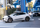
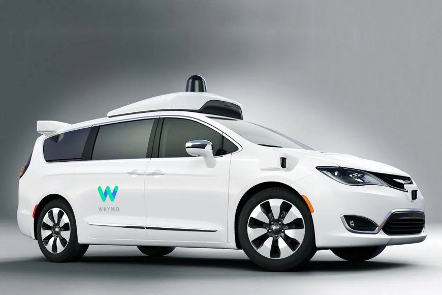
Waymo and Waze announced a pilot data-sharing program that uses information gathered by autonomous vehicles to help cities address road issues more efficiently. The initiative will send pothole data collected by Waymo’s robotaxis to a Waze platform designed specifically for city use. As the program grows, any city or state where Waymo operates will be able to access this information.
Waymo currently runs commercial services in 11 cities and continues to expand testing into additional locations. The pilot program will initially focus on five key markets: Austin, Atlanta, Los Angeles, Phoenix, and the San Francisco Bay Area. In these regions alone, Waymo says its vehicles have already identified around 500 potholes. The companies plan to extend the program to more cities over time.
The data won’t be limited to city officials. Users of the Waze app in areas where Waymo operates will also benefit from this information. In fact, drivers using Waze will be able to view and help confirm pothole locations, improving the accuracy of reports through community validation.
Waze already allows users to report potholes manually. Still, this new initiative aims to enhance the system by automatically collecting data from autonomous vehicles and making it more accessible to municipalities.
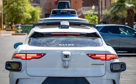
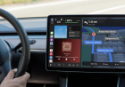
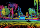
Waymo’s robotaxis are equipped with advanced technologies, including cameras, lidar, radar, and other sensors, which make them particularly effective at detecting road hazards like potholes and surface damage.
While other companies have used sensors in vehicles or smartphones to gather traffic and infrastructure data, Waymo appears to be among the first to leverage a robotaxi fleet specifically for this purpose.
The collaboration also reflects a broader strategy. Autonomous vehicle companies are working to strengthen relationships with cities as they expand operations. Providing useful data — such as insights into road conditions or hazards — can help build trust and demonstrate value beyond transportation services.
This is especially relevant as Waymo accelerates its expansion plans, aiming to operate in more than 20 cities within the year. According to Waymo, the idea for the program came directly from feedback provided by city officials over time. The pilot is intended to close reporting gaps and support ongoing efforts to maintain safer road infrastructure.
Sarah Kaufman, director of the New York University Rudin Centre for Transportation, highlighted the significance of the initiative in a statement shared on Waymo’s blog. She noted that sharing such data reflects a responsible approach by companies operating on public roads, helping cities respond more quickly to issues and improve overall safety for everyone.
What's Your Reaction?
 Like
0
Like
0
 Dislike
0
Dislike
0
 Love
0
Love
0
 Funny
0
Funny
0
 Angry
0
Angry
0
 Sad
0
Sad
0
 Wow
0
Wow
0